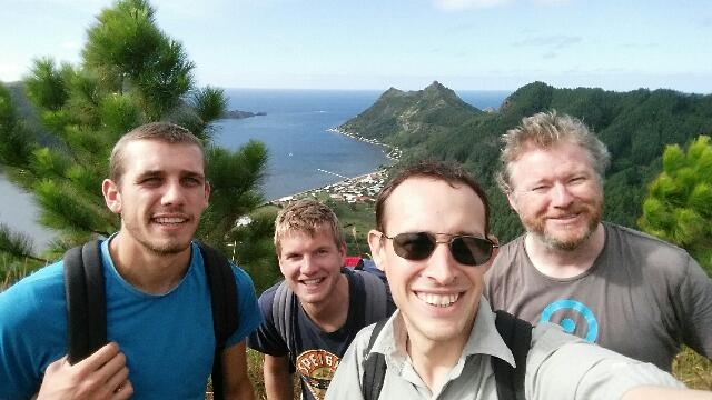
Ohana
Cuxhaven
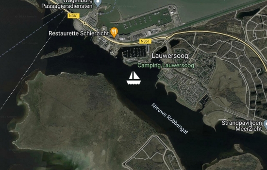
Lauwersoog
Harlingen
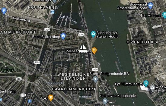
Amsterdam westerdok!
Breskens
Avg: 3.3knts
24hr: 80.2nm
Anchored off ramsgate
Dungeness waiting for tide

Sussex yacht club, shoreham
Weymouth
Totnes
Dartmouth
Fowey
Falmouth
Avg: 6.1knts
24hr: 145.3nm
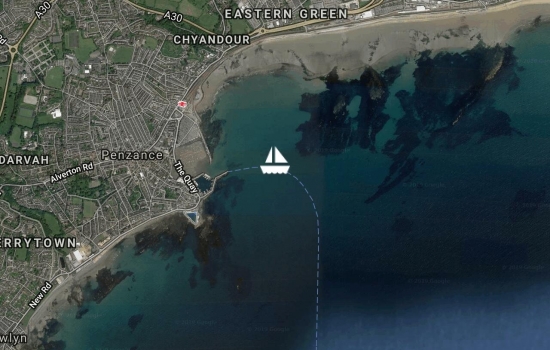
Penzance

Avg: 9.3knts
24hr: 222.5nm
we've had two days of strong winds and big waves, probably broken a few records for Ohana, surfed some huge waves... Max speed was 20 knots! Now the sun has come out, the wind is dropping and the seas are getting much more regular but still up to 6m high. The music is on and dolphins are playing around us, great fun sailing conditions.

Avg: 6.4knts
24hr: 153.7nm
nearly half way there! Wind is filling in from the east after a day of motoring. Forecast looks good for moderate to strong tail winds from here onward, hopefully make good speed. A stop in Ireland is looking more likely depending on how the forecast develops.
Sent from Iridium Mail & Web.
Avg: 6knts
24hr: 144nm
we've covered a lot of miles over the last 24 hours, maybe a record for Ohana! Wind dropping off gradually now. The satphone has an intermittent problem - sometimes it stops charging and then the battery goes flat so don't worry if our position reports are sometimes irregular. Sent from Iridium Mail & Web.
Avg: 8.8knts
24hr: 211.5nm
Wind picking up. Making very good speed now, 9-10 knots as we broad reach in 25 knots of wind. Great sailing!
Avg: 8.7knts
24hr: 208.4nm
We picked up a fair wind early this afternoon and stopped the engine. Now making good speed under sail. Wind SW15, speed 8kn, COG 033. All's well. Sent from Iridium Mail & Web.
Avg: 71.7knts
24hr: 1720.8nm
We are on our way! Lovely sunny day. Flat calm. Motoring north east to find some wind.

Avg: 12knts
24hr: 288nm
Arrived safely in a breezy Bermuda! Going ashore for lunch :)
Avg: 10.1knts
24hr: 241.6nm
Another beautiful sunny evening. Due to a rip in the mainsail we are using an unusual sail plan (trysail+jib+reacher) but conditions happen to be perfect for it and we get to practice using all the special sails in nice weather! Still averaging 7 knots and the forecast looks good for the rest of the passage. Wind SE 12kn.
Avg: 352knts
24hr: 8448nm
We departed green turtle cay at 6am, now clear of the outer reef and making over 9 knots on a course of 005t. Beautiful sunny morning, perfect conditions for Ohana. Wind ESE 21kn.
Sent from Iridium Mail & Web.
enjoying Warderick wells in the exuma national park
Anchored off Palm Cay marina
shroud cay
staniel cay
Avg: 5.8knts
24hr: 138.7nm
Arrived george town
Arrived Rum Cay
Arrived Mayaguana, Bahamas
Avg: 5.1knts
24hr: 122.8nm
Arrived Provo, Turks & Caicos
Departed Port Antonio
Arrived Montego Bay

Ohana - Photos from the voyage to rapa
We're struggling to get usable Internet here but this is an attempt to upload some photos of my birthday cake and the pay we made for the engine on the way to rapa. Photos of rapa coming soon if this works!


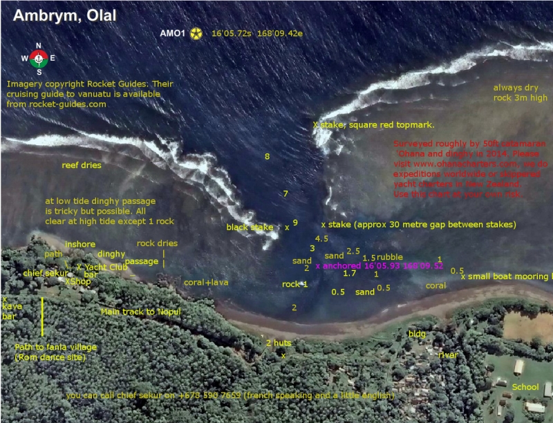
Ohana - Pilotage chart of Olal, Ambrym, Vanuatu
We were warmly welcomed by the villagers at Olal who have built a brand new yacht club and bar there and organise the annual Rom dances and Back to my roots festival. Unfortunately yachts never visit there and anchor an hour's walk away just because Olal is not in any of the cruising guides or pilot books. We decided to fix that and carried out a survey of the anchorage which we will submit to all the vanuatu cruising guides... here it is so you can be one of the first yachts to visit!
Further Read more...
Neighbouring Nopul is a good anchorage (Much better than Ranon) but it
means a very long walk to Olal including crossing a ford which can be impassable
after heavy rain. We spent 3 nights there before moving to Olal to do
the survey.
Olal has the new yacht club and bar and is where chief Sekur lives.
The Rom dances and two annual festivals are held about ten minutes
walk inland and everyone comes back to the yacht club afterwards.
While we were there the BBC were filming a documentary primarily about
the volcano but also featuring the dancing at Olal. The
villagers there are doing good things to raise money for the school,
keep their traditions alive and put on wonderful events where the
dances are very real, not just put on for tourists and they are making
a real effort to attract yachts. Chief sekur has travelled widely as a
cultural ambassador for Vanuatu. He can organise dances, pig feasts
and open the bar any time, all night on occasion! The chief at Nopul
was also very friendly but there is not much to do there.
I would say Nopul is the better anchorage in trade winds mainly
because it is bigger but on windy days you can get random gusts and
swing about there. In Olal the wind is less gusty and there is a
steady breeze which is better for ventilation and power generation,
not much swinging. The reef offers good shelter from all sides except
from the north. We had winds from due east and although the waves can
wrap around the end of the reef a bit our anchor location still had
very good shelter. It could be a little rolly right at the top of the
tide for a monohull but otherwise very calm.
The depth soundings were calibrated roughly to spring low tide.
The least depth I saw on the sounder as we swung at anchor was 1.9
metres and deeper water was available nearer to the entrance.
Waves were not a problem in the entrance at all in the conditions we
had but they did come over the reef towards the dinghy channel a bit
at dead high tide.
Locals reported that a major tsunami or storm surge a few years ago
had drastically altered the anchorage, destroying the wharf and
reducing the depth by several metres. silting up may be continuing and
the sands may still be shifting. Locals who came aboard were surprised
when they saw our depth sounder, expecting a lot more water (a small
cruise ship used to visit Olal until the wharf was destroyed).
We had only about 15m of chain out, there would be room for maybe 2-3
big yachts in there on short scope if they are not too deep drafted, plus a
couple more cats if they have daggerboards.
Holding seemed very good but avoid the rubble near the reef, there
were a few larger boulders there which could snag an anchor.
A new airstrip is under construction at Olal near the school, nearing completion
now. I got the impression Olal hope to become the main transport hub as well
as already being the main cultural centre of Ambrym.
As the waves push water in over the reef the current appeared to always flow
towards and out of the entrance and can be strong between the inner pair of stakes
and in the small boat channels both sides of the harbour, especially in the first half
of a falling tide. this current probably helps reduce swinging but might make it
unsafe to swim.
To download the chart - click on the image of it at the top left of this blog. A bigger but still squashed version will appear. Right click on that and select "save image as..." or the equivalent option in your web browser to save the full size image.
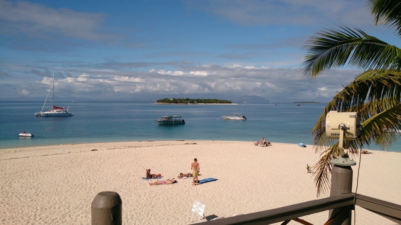
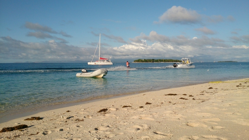
Ohana - Beachcomber island
Beachcomber island is welcoming to yachts and has moorings available. Free mooring with $10/person landing fee. It's a backpacker resort on a tiny island. (Etai island according to the charts)