NOVAE
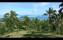
Scotland Island, Pittwater near Sydney.
This should have been posted a long time ago, but when you sell your boat, your life gets upside down for many reasons.
That's where the new owners Peter and Debbie live (for the time being), they will move onto NOVAE as they feel comfortable with the life-changing shift.
We are back in Perth trying to adjust to lundlubber's life.... Helen happier than me, looking after the grandchildren (and the children...), I am busy fixing their stuff, building new stuff etc etc.
Adriano has just started designing our new house on the hill, but it will take a long time: design, preliminary approval, construction drawings, building approval, scheduling, subcontracting ..... the list goes on. Will I resist???

Newcastle AU, On the "T" of B jetty
We are in Australia! What a ride we had, all the time trying to slow down.
This morning we were doing 9kn with 1/3 Genoa only.... great weather! We anchored in a beautiful bay in Broughton Island, had a swim, sunbathed a little and started to cook all our left over veggie, mushrooms etc.
A huge thunderstorm came over us, I put the lightning dissipator in the water and watched it come through, the wind went from 10 to 38kn, deafening thunders and scary lightning, sprays where lifting from the water and being swept away, all within 3 min.
The forecast did say "chance" of a thunderstorm, but I wish I had let more chain out to begin with....
Had a pleasant, restful night. Now motor sailing in light winds towards Newcastle, will be in our berth by midday.
Avg: 8knts
24hr: 190.9nm
0600, 80M from Newcastle. Had a great sail yesterday and a bit of a bumpy night as the wind increased to 25~28kn. Looking forward to the last of the lasagna and a glass of wine tonight. 168 mile day. Currently sailing with 2 reefs and 10% Genoa to slow down both for comfort and to arrive Mon am.
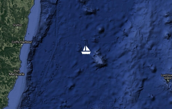
Avg: 5.8knts
24hr: 138.2nm
240M to Newcastle. Had a bit of a dull day, the seas where still up to 3.5m in the morning, down to around 2m later, but we had light winds all day motored a bit, mainly to make power under the clouds. 132 mile day. n Genoa only at the moment, but hoisting the main at sunrise.
Avg: 8.4knts
24hr: 202.3nm
Had a wild night, with gusts to 33kn and rainy squalls. 3 reefs and 1/3 genoa. 180mile day. 360 miles to go.
Avg: 6.3knts
24hr: 151nm
Had one of the best sailing days, under Genoa only with winds around 15kn all day clear sky and slight seas. Slowing down so as to arrive on Monday am. 131NM day

Avg: 8.9knts
24hr: 212.5nm
Had a pleasant night, with mostly SSE winds of 18~22kn. 186 mile day.
Taken the main down as it was swaying too much in the light wind.

Avg: 5.8knts
24hr: 139.4nm
Had a blast out of Noumea!!! At 20:00 yesterday we had been underway for 10h and we traveled 92NM, that's an average of 9.2kn. We touched 15.4 at some stage.
The wind has been 18~22 all day, we keep the apparent to 80º, the swell is below 2m, 1 reef on the main and half a Genoa.
We then took another reef and traveled the night slower for comfort.
Nice sunrise through the clouds calmer sea and lighter wind this morning.
Left the marina and now in the Noumea anchorage area.
Tomorrow morning after immigration we will leave, probably 0900.
The weather to Newcastle looks better than yesterday, actually it has been getting better for the last three days....strange, but nice!!
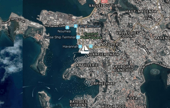
In Noumea, Port Moselle Marina. Helen is leaving tomorrow for Perth by plane, I am planning to sail away on Monday 5th AM, should be in Newcastle on Monday 12th. Cannot hear GHR from the marina.
Port Koube in Ouen Island, New Cal. Very calm anchorage with no signs of civilization. Going to Noumea today to get ready for the passage to Au, probably leave on Mon 5th.
departing for Newcastle on Monday
Kuto Bay, Ile Des Pins. Great bay in the most sought after island of New Caledonia. Normally very calm, but we had a somewhat rolly night as the winds were from WSW. Turning SW now.
Port Kouture, Southern Lagoon, New Caledonia.
Had to motor most of the way in light wind from Ile Amedee, but not before having another wonderful dive, this time on the wreck of the Thoho5, a fishing vessel sunk by the authority for diver's enjoyment (~ 22 28.9S - 166 26.6E).
You can see the holes cut above waterline to facilitate sinking and the explosive holes under the waterline to start it sinking on an even keel in 25m of water. One can dive into the wheelhouse, engine room and the accommodation, disturbing huge fish, not afraid of human as fishing is forbidden in the nature reserve.
The sun was high, no wind, no swell, 25~30m visibility: it doesn't came much better than this!!! Port Kouture is a very quite anchorage protected by high hills on N and E and an extensive reef elsewhere, a good overnight stop on the way to the Ile des Pins
Still Ile Amedee, near Noumea.
Yesterday had a great dive on the wreck of 'La Dieppoise' an ex patrol ship scuttled here in 1988.
After 33 years underwater, the wooden hull has completely disintegrated to leave a perfect view into the interior of the ship and the aluminium structure guarantees it will hold well against oxydation, for both the pleasure and safety of the divers. Fish everywere and the vis was great! Pos: 22º 29 S and 166º 26.39 E, there is a buoy to tie the dinghy.
Still at anchor behind Ile Amedee, near Noumea. Had a dive yesterday on the reef, tried to find a wreck, but couldn't. Will try again today.
Waiting for the first opportunity to make the final jump to Newcastle, Oz
at anchor behind Ile Amedee, a small island with the tallest lighthouse in NC. Built out of iron in France and shipped here in the 1800, similarly as the Eiffel Tower. Looking forward to go diving with Hugh from Scotia on the two wrecks nearby and the great coral reef on the outer pass and everywhere around here.
Avg: 6.4knts
24hr: 153nm
approaching grande terre, New Cal
On our way to Noumea. Left Port Vila yesterday 0900 and been bashed about for several hours in a choppy confused sea up to 2.5m high. The wind has been ESE at first and managed to put a lot of South in our route, but we lost it overnight as the wind shifted S.
Our course is now taking us N of the rumb line.
Port Resolution is a nice shallow harbour, 4m sandy bottom. A little rolly, but acceptable.
there is a resort that calls themselves 'Point Resolution yacht Club' they have a club house reminiscent of Big Mama, Tonga, just smaller.
We had dinner there last night and after all arrangements made to have 1 vegan curry and three fish dinners, we got 1 boiled veggies and rice and 3 omelets and rice.......
From the anchorage we can hear the volcano puffing every now and then and at night we can see the glow.
We booked a tour and were herded in a small pick up truck with another 9 people, 13 in total. Because we booked first, our two Helens sat in the cab, the other 11 of us were jammed together in the tray at the back, it was grueling, but the walk on the volcano rim was great!
It was rumbling all the time and every 10' or so it would blow and spew red lava up into the sky, occasionally 100m or so.
Tanna was hit hard by the cyclone and you can still see the damage everywhere, the people are coping with it, they are used to this.
They say that the aids are not filtering through the government tangled web, but I get the impression that they play on that and keep asking for small gifts etc.
I visited the village and school and found a lot of dirt, people seem to not care and just lay around doing nothing.
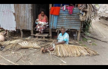
I did not see anybody working hard to rebuild anything except for some old women weaving roof covers.
I get the feeling that they just wait and ask for aid, similarly to people on welfare that like to 'get' without 'deserving'.
Regardless, we have given away a lot of staples and a few treats and in return got lots of drinking coconuts, a three green tomatoes and a sweet potato.
Will leave tomorrow AM for Port Vila, should be a 22h passage.
Hello Stefano and Helen,
Avg: 6.6knts
24hr: 157.4nm
Lenakel, Tanna Is, Vanuatu.
Checking in was easy and quick, customs and immigration are in the same building, 100m from the beach where you live the dinghy.
No sealed roads, no ATM, no market, just a few shops full of cans of mackerel.... people are all nice.
Tanna was hard hit by cyclone Pam in March and the devastation is still visible.
Avg: 8knts
24hr: 192.7nm
140M from destination.
Had a better night with SSE up to 20kn. Sailing with the wind at 50º apparent averaging 7.5kn. Enjoyed the Pad Thai better than the pesto pasta of last night....
Passed a boat at 03:30 who did'n answer radio calls.
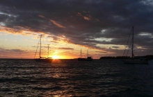
Great Pacific sunrise, blue skies with some puffs of pure white clouds.
On our way to Lenakel, Tanna Is, Vanuatu, the Volcano Island.
Left Fiji yesterday 1030 and had a bumpy ride all day and night with SSE winds between 25~30kn.
Better condition today with seas calming down to an acceptable level.
Lautoka. Second biggest city in Fiji. The sugar cane capital of the Pacific. Going sightseeing tomorrow then stocking up before leaving for Lenakel on the island of Tanna, Vanuatu on Friday 7th Aug.
Robinson Crusoe Is.
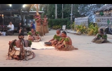
Enjoyed a great cultural show last night! Highly recommended to all cruising this way.
Wednesday and Saturday nights only. $25 includes dinner and show, great value.
Momi bay, SW Viti Levu. This is a very quiet bay, a welcome change from the "Hollywood" of Port Denarau where we spent a couple of days waiting for our friends Chris and Helen from Perth.
After breakfast we will sail to Robinson Crusoe Island to watch the best Pacific Island Cultural show, with fire dancing and food cooked underground.
Hope to see you soon again!
The show was great!
Avg: 324knts
24hr: 7776nm
In Suva harbour close to the Royal Suva Yacht Club. Had a fast trip from Fulaga with 25kn winds from SE gusting to 30kn, up to 3.5m sea. Had a guest: Lai, the chief's daughter, that is flying back to the USA, if I hadn't given her a lift, she would have had to endure a 4 days ferry trip, sleeping on the floor....
Fulaga, near pass, nice snorkeling and incredible landscape, small beaches and dozens of motus scattered in a calm lagoon. Going for dinner at the village tonight.
Fulaga, near road to village. Had dinner at our host's house followed by lots of grog (kava), walked back to boat in the dark drizzly weather. Today if the sun comes up, will go for a dive on the pass.
Fulaga is amazing!! We had a good sail to get here, but this place is worth 3 days of beating!! It will remain in my memories as one of the top (if not the top) cruising destinations.
Yesterday we had Sevusevu with 7 other boats!! We were allocated a host family, Salotte and her husband Mini the carver, very nice people, then we drank kava with the chief (who being old, doesn't drink it any longer....) and a few other top ranking villagers.
It has been raining, so that has hampered our exploration, we are looking forward to some sunshine, but it's overcast..
Anchored in the Fulaga lagoon, S Lau. Had a great sail from Taveuni mostly with winds on 60º apparent. This is a magnificent very protected place definitely worth the long sail. Loking forward to our introduction to the village chief this morning at 10:00.
En route to Fulaga in the Southern Lau, 30M to go. Had a great start of the trip with ENE wind 15~20kn all day yesterday sailing at 8~9kn. The wind died at 4am and been motoring ever since. Currently picking up, so will hoist sails again.
Namena Island National Park. Nice snorkeling along the island and great scuba on the outer reef. Thousands of birds nesting in the trees.
This is a private island and the resort charges FJD 15 for a 4h walk permit! However once you paid the National Park fee of FJD30, you can dive and snorkel around for 1y.
Back in Navatu to see our friend Chief Lepani
Back in Savusavu for provisioning and picking up friends on honey moon. Leaving Mon eastwards.
Naiviivi bay is a beautiful long bay, very well protected from all winds. Mangroves everywhere, soft mud bottom.
Arrived just before sunset, relaxing with a beer and looking forward to kayaking in the morning.
Viani bay is a beautiful protected anchorage. Snorkeling and diving on the Rainbow reef is not to be missed!!!!.
Fawn harbour is a very protected anchorage with several Caucasian settlers, nice locals and hot springs. Good sandy anchorage and plenty of reef.
Mbua. A nice big anchorage on the West coast. Cought up with Wendy and Ian from 'Outsider' whom we had not seen since Vava'u, great raw tuna dinner!!
Navatu. Chief Lepaniqio came on board, asked for A3 batteries, given 4. Wants us to go see his village next time, as we did Sevusevu in other village just north of his. The inlet is surrounded with thick mangroves and makes for great kayaking, nice snorkeling on the outer reef.
On a mooring ball in Savusavu. Clearing was pleasant and easy, no problems with any of the officials. Had a walk ashore and lunch at the Yacht club. Nice friendly atmosphere, we are happy to be here.
We blasted through the Koro Sea at an average 8.5kn with a top speed of 16.2. Fiji certainly gave us a great welcome!! Will be in Savusavu around 08:30.
Avg: 13knts
24hr: 312.4nm
Savusavu. Cleared customs and immigration. Nice town 3 banks, several shops and a good fresh produce market.
Avg: 6.5knts
24hr: 155nm
Had a nice night under Code0 with wind from the SSE between 13~16kn. 140mile day.
Avg: 4.7knts
24hr: 113.9nm
Had a nice 10~12kn Sly breeze most of yesterday which died about 2am so motored for a few h. Breeze was back around 0500 and we got sailing again, albeit rather slow, better than the bashing we had on the way to Minerva though!!!.
At sunrise we hoisted the Code0 and now we are sailing wing-on-wing Code0 and Genoa at 6.5kn. 150mile day.
Had a pleasant night at Minerva reef, the wind shifted to S last night while we were watching a movie and it has remained Southerly, will leave for Suvasavu soon
Avg: 5.4knts
24hr: 129.4nm
Motorsailed on Genoa only during the day and motored all night against headwinds and waves, but got into Minerva North reef ok. 12 boats here and more on their way, party time.....
Plenning to leave for Savusavu on Monday.
9m from Minerva
Avg: 6.1knts
24hr: 147.5nm
Yesterday morning the main halyard chafed through at the masthead and the main came down, no major drama, we zipped it away, but then, we only had the furled genoa and with winds gusting to 33kn I was no game to unfurl it all the way. We are now going slower and not able to point less then 45º to the wind. We will have to motor perhaps a day to get into Minerva.
Another day we all want to forget, 140mile day.
Avg: 7.5knts
24hr: 181nm
Had another rough night, with light winds to 26kn and rough sea, looking forward to the end of it. Had to alter course 10ºN as we were bouncing into the 3.5m smell too hard. We will make to Minerva reef on this heading and might consider proceeding to Fiji.
Avg: 4.8knts
24hr: 114.4nm
Avg: 6.4knts
24hr: 153.9nm
Had an unpleasant night, bouncing around and with every second wave over the deck! Sailed with three reef on the main and 1/2 genoa. still doing an average 6.2Kn.
Avg: 6.7knts
24hr: 160.9nm
good radio signal and thanks for relay
Avg: 4.6knts
24hr: 110.7nm
Had a pleasant night in light E winds, not hoisted the sails yet.... 150mile day.
Getting ready to leave Opua, New Zealand bound for Minerva Reef, then Fiji. Customs first, then fuel, then GO!!! date: 02/05/2015
Relaxing, again, in a little bay on the island of Kawau (sounds Hawaiian doesn't it? Might stay a couple of days if the weather clear.... been cloudy for days now!!
Mangawhai Harbour. Nice holiday settlement with shops, tavern etc. Beautiful sandy beaches either side of the inlet. Shallow sand bank at the entry can break in SW seas.
Marsden Cove Marina. Lovely , well kept marina run by friendly and helpful people. Not much to do here, just one cafe shop. Whangarei is 30km�by car or 11NM by boat, all facilities there, including Bunnings, gas fitters, all marine chandlers and refitters.
Anchored in Bland bay, nice long beach with cottages and a caravan park. Will leave early tomorrow morning to go to Whangarei.
Anchored in Urupukapuka Bay. This island is controlled by the Dpt of Coservation and has excellent walking track all around. We walked up a couple of hills and enjoyed great views over the Bay of Islands.
Allegedly there are scallops in Albert Channel
Spent yesterday at anchor in Paihia, had gusts of 32kn, rain squalls and we were cold!!! When is the spring/summer coming to this beautiful Bay of Islands? Today we are on a mooring in Russell, the historical first Capital of NZ. Looking forward to go for a walk and coffee in town.
In Opua Marina, North Island. We cleared customs and immigration quickly yesterday and are now enjoying the NZ cold weather..... It will get better! We went out for lunch and dinner and greatly enjoyed both as well as the warm NZ hospitality. Spent all morning cleaning the boat and now looking forward to some ralaxation and island exploring.

Avg: 6.8knts
24hr: 163.6nm
We are in the Q dock waiting for clearance tomorrow morning.
84 to Opua at net time. Good radio
Avg: 7.5knts
24hr: 180.9nm
Had a bumpy night, with increasing NW winds, finally sailing straight towards Opua with two reefs, will arrive later this afternoon
Avg: 6.7knts
24hr: 160.9nm
Another 24h with the motor running, occasionally motor-sailing. 238M to Opua.
Avg: 6.3knts
24hr: 150.9nm
Motored last 24h in light winds from SE, S and SW, in a big slow rolling sea. Only averaging 5.4kn. A real pain. Still on schedule to arriva Mon 3rd if we get some wind, but all my GRIBs show is light wind, including Monday???
Avg: 7.3knts
24hr: 175nm
Motor sailed all night in light winds, 150mile day.
Avg: 6.7knts
24hr: 160.3nm
Currently about 130M from Minerva Reef. Had a pleasant night, with mostly light winds, motored for the last 4h.
Minerva Reef!!! Had a very pleasant sail yesterday cruising at 7 to 8 kn, Slowed down to 4 overnight to arrive at daybreak. Had a swim in the cold (21º) waters and now getting ready to set sail again for Opua, NZ as the weather is favourable.
Avg: 4.8knts
24hr: 114.9nm
stopped for breakfast but will leave today as the weather window is good for NZ . will leave with 12 other boats so plenty of company!
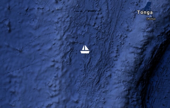
Avg: 3140knts
24hr: 75360nm
Corrected position update
Had a pleasant night, with moderate winds 16~20kn and just a couple of gusts to 24 & 26kn. 1 reef in the main. 180mile day.
Just left Tongatapu form Minerva Reef. Will slow down to get to Minerva around 11am on Wednesday.
In Nuku'olefa wqaiting for the right opportunity to set sail to NA!!
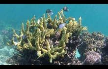
We enjoyed Kelefesia, beautiful cliffs, sand bar and forest full of birds. Great snorkeling all around with coral towers and ledges, mostly live coral.
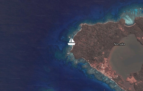
in hapaais and soon off to Tongatapu for clearance to NZ
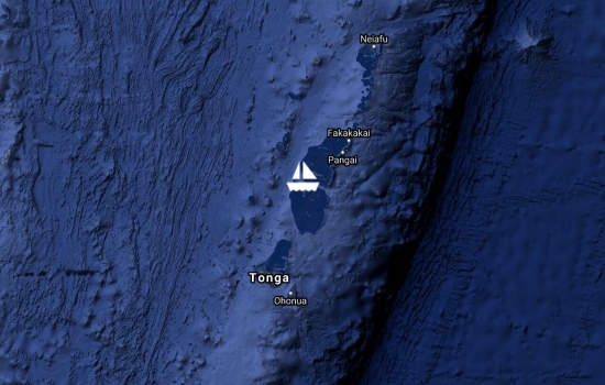
Anchored on SW corner of Nomuka Is, in the lower Hapai group of Tonga.
Good holding in 16m sand with the occasional coral boulder. Rolly anchorage, nice snorkeling.
No blogs available for this yacht.


