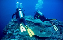
Saraoni
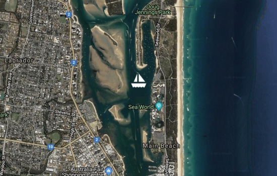
Saraoni is now up for sale as we have bought a newer, larger yacht. see this link https://yachthub.com/list/yachts-for-sale/used/sail-monohulls/south-coas...
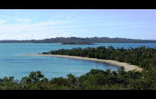
At Jacob's Well. Not too busy despite the holiday season.
Spent New Year's Eve on the Brisbane River.
Anchored off New Farm, Brisbane for New Year's eve.
Anchored off New Farm, Brisbane for New Year's eve.
Quite a busy anchorage off the small community of Dunwich, North Stradbrooke Island. Going for a cycle ride to Blue Lake and then tomorrow up to Tangalooma, Moreton Island while the weather stays settled.
Avg: 4.3knts
24hr: 104.2nm
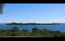
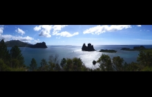
Nice anchorage at uninhabited Peel island.
Left the Great Sandy Strait yesterday over a bumpy Wide Bay Bar. Now just off Mooloolabah on way to Moreton Bay.
On the way into Tin Can Bay. Not expecting too much wind from ex TC Owen.
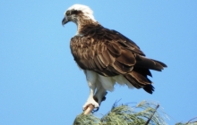
The sandbanks are teeming with bird life. Some resident and some migratory. There is a notice on the shore warning about the presence of crocs. Haven't seen any yet.
Not expecting much effect from Cyclone Owen but won't be crossing Wide Bay bar until mid next week when the swell is down.
Heading slowly through the Sandy Strait to Tin Can Bay. Forecast for the weekend has moderated so not expecting high winds. Next chance for the Wide Bay bar will be in a week's time.Have to be in Southport by 7th January for the survey of a yacht we hope to buy.
Beautiful day up the Burnett River. 70 boats in The Go West rally have been enjoying rally events in Port Bundaberg Marina. Some will be heading south when the wind drops in a day or 2.
Back up the Burnett River for a few days. Sharing the river with flocks of birds.
Motored back down to the Port Marina for compulsory timber interior inspection for what we assume is some type of borer. This will be the longest time we have ever spent completing full clearance formalities a total of 6 days.
Nice gentle motor up the well marked Burnett River. Last here in 2006 and it hasn't changed much despite two major floods. Mid town marina completely demolished but anchoring appears to be allowed anywhere.
Avg: 5.1knts
24hr: 123.4nm
Great weather to arrive in Australia. No thunderstorms.
Avg: 5.8knts
24hr: 138.9nm
88 nm to the Breaksea Spit light north of Sandy Cape. No shipping sighted yet. Hope to be at Port marina, Bundaberg Thursday morning.
Sent from Iridium Mail & Web.
Sent from Iridium Mail & Web.
210 nm to the Breaksea Spit light north of Sandy Cape. Trough passed through over night with lightning, rain and the return of the trades. Bye bye nice, flat sea!
Avg: 5knts
24hr: 120.1nm
330 nm to the Breaksea Spit light north of Sandy Cape. We had about 1.5 knots of countercurrent most of yesterday and a light headwind before the wind shifted to the South, which then died later. The Coral Sea is now flatter than NC'S Southern Lagoon! Don't expect significant useful wind until tonight when the trades return with the next high. ETA Bundy Thursday.
428 nm to the Breaksea Spit light north of Sandy Cape. We had about 1.5 knots of countercurrent most of yesterday and light headwinds.
Current reversed last night but negative again now. Nice moonlit nights. Sequoia, Irie 2 and Silhouette in front by a few miles and Penn Station joined the fun yesterday. One yacht reported being pursued by 9 mahimahi. He tried to hook one but no luck. Don't expect significant useful wind until Tuesday a.m. ETA Bundy Thursday.
520 nm to the Breaksea Spit light north of Sandy Cape. Wind now a 4 knot westerly. We still have a 1 knot countercurrent. Sequoia, Irie 2 and Silhouette in front by a few miles. Our email address is saraoni2@myiridium.net if anyone needs to contact us.
585 nm to the Breaksea Spit light north of Sandy Cape. Wind has dropped out completely. No shipping and 1 yacht behind us called Katfish. Sequoia, Irie 11 and Silhouette in front by a few miles. Our email address is saraoni2@myiridium.net if anyone needs to contact us.
.
Sent from Iridium Mail & Web.
645 nm to the Breaksea Spit light north of Sandy Cape. Wind has dropped a lot from yesterday. A lot of shipping and a few yachts around, too.
On mooring at Maitre - leaving for Bundaberg today
Anchored in Baie des Citrons, final preparations before take off tomorrow for Queensland. Mixed bag of weather. Wind to start, then a hole, then trades before arrival. Avoiding arrival in Oz with a trough lurking. Saraoni is going home to be sold and we are buying another boat to sail to NZ
In Baie des Citrons preparing to leave for either Bundy or Brisbane, considering leaving Weds. The 2 models look, as usual, about as consistent as the Brexit negotiations in a week's time!
In Noumea, off by car to the Chutes de La Madeleine for a swim and a walk. Looking for a passage to Oz in about a week to buy another boat.
Beautiful morning at Mato island.
Spent the day at the reef edge snorkeling in crystal clear water.
Lovely calm conditions at Ua island in the southern lagoon of New Caledonia. Nice coral and white tipped sharks.
Avg: 73.5knts
24hr: 1764.3nm
Anchored just outside Isle Mato lagoon. Plenty of rain visible over Grande Terre.
Climbed the 313 meters to the cellphone tower and wandered around the old jade mine. On to Ile Mato today and Ua and Kouare on Sunday and Monday.
Anchored in Baie Ire, in Canal Woodin. Ouen's creeks are still running, testament to the number of fronts and troughs that have rolled through this year.
Hope weather improves for last trip to Isle des Pins
Returned to Baie Orphelinat after climbing 775 metre Mont Dore yesterday. awesome views over the southern lagoon. Going back to ile des Pins when the wind eases next week.
Off to climb Mont Dore today.
Anchored in quiet Anse Kuendu.
Great day to be on the reefs in the lagoon but busy with the public holiday, New Caledonia Day.
Anchored off Ile Ngea today.
Good anchorage for wind shifts.
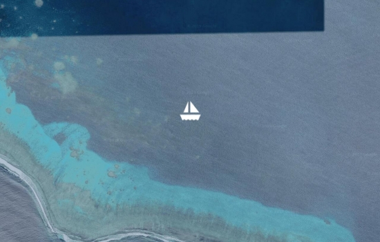
Beautiful colours on Tabu reef. anchored in 5 metres of crystal clear water and went for a snorkel. Dive boats were taking in turns using a mooring nearby. So going to use our hookahs next time we get out there.
In Port Moselle marina, leaving today. Marina busy with comings and goings. Poor HF reception as usual in the marina
Avg: 3knts
24hr: 71.7nm
Lenakel is not the best of anchorages with a large swell breaking on the nearby reef but it does have good internet, all officials in the small town and an ATM and they will do the paperwork at the weekend. Sheltered spot to put the dinghy.
Avg: 3.7knts
24hr: 90nm
7 miles from Mare Island in the Loyalties at 1.26 am. Had a counter current so have been motorsailing.
Anchored at Kuto, Ile des Pins. Leaving for Tanna today. Will have no weather info until Tanna so hope to get a sim in Lenakel if swell not too bad. Also, new BSP in Lenakel with an ATM for international cards, but have to get out before the BFH arrives.
On mooring at Ilot Maitre, cleaning hull and changing filters. Clearing customs for Tanna later this week.
Pleasant in the lagoon not too windy at Amadee yesterday. Plenty of tricot rayes on the shore.
Leaving Prony heading back towards Noumea for last minute shopping before leaving for Tanna
On a mooring at Ilot Casy. Will be heading to Vanuatu in a week or so. New plaque by the jetty in memory of Moose, the island's best known resident who died last December.
Avg: 3.8knts
24hr: 91.7nm
Hiked up to Cape Ndua, good whale watching spot but only one whale sighted in the distance.
Hiked up to Cape Ndua, good whale watching spot but only one whale sighted in the distance.
Hiked up to Mt Malaoui in Mt. Koghis, Beautiful views from the top.
Managed to rent a mooring in the bay for $5 US a night so we can do some hiking in the nearby mountains for a few days.
Took a free mooring overnight at Ilot Maitre. Turtles, snakes and bird life. It's a protected nature reserve for both marine life and birds. There is a hotel, swimming pool and restaurant
Anchored in Baie Ste. Marie. Good for supermarkets when wind is westerly. A bit bumpy now so going round into crowded Baie d'Orphelinat.
Anchored at a nice small coral islet. No whales sighted yet,
Not a particularly nice day. We passed our track for circumnavigating Le Grande Terre yesterday, Now we have to plan what to do in the next 3 -4 months. probably head to Vanuatu for a bit and then back to New Caledonia.
The clear sky has gone today. Moved to an anchorage sheltered from forecasted SW winds but no wind at present and cool.

Spent the day at Ilot Tenia in fantastic calm weather. Good snorkelling and saw the largest brown moray eel that we have ever seen before. Also a 2.5 m grey shark cruised by the boat.
Avg: 34.2knts
24hr: 821nm
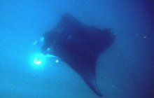
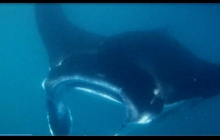
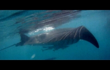
Motored a few miles down the coast to the Lepradour Channel, near Baie de St Vincente. Spotted some manta rays so jumped into the sea to take photos.They must have been feeding in the soupy current. The remoras hanging around were more bothered by our presence than the mantas!
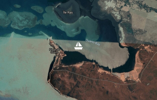
Spent 2 nights here after winding our way through a narrow channel which has green and red beacons marking it.
Arrived in the southern lagoon at 7pm last night. Much clearer water and more marine life. Dugongs and turtles. Spent the morning at Konduyo Island. Expecting stronger winds tomorrow,
Just a short 15 mile motor sail today, wind got up to 20 knots at 10 am so not worth bashing into. Nice anchorage today and good beacons through the reefs. Navionics on android up to now has been very reliable for both depths and positions.
Anchored in Chessaloup Bay, near the village of Voh. We camped here earlier this year on our cycle trip. Beautiful calm morning. Staying here a couple of days before motor sailing further south. Wind direction and strength not very well forecast along this stretch of coast as the wind is affected by topographical features too much. Window possibly opening up at the weekend to reach the entrance to the Southern lagoon near Baie de St Vincente.
Anchored in the well sheltered Baie de Gomen after an easy 11 nm run south east from Koumac. We've started our 150 mile run to Noumea, mainly into the wind, but with day hops of 20 miles in and out of the lagoon. Heading for Voh (Baie de Chasseloup) today.
Checked into the nice well priced sheltered Koumac marina for a few days while stronger winds pass. Will probably head further south tomorrow. Going for a cycle ride today.
Anchored in Tanle Bay. Wind shadow area in these large bays and down to Koumac . Did get up to 12 -15 kn E yesterday in the middle of the day. Heading to Koumac today, 20 nm South of here.
Pleasant morning. Heading a few miles south today.
Anchored at Poum. In a wind shadow!
Anchored off the village of Poum. Plenty of pretty island and mainland anchorages around here to choose from. Gas station and store onshore and even a bus service 3 times a week to Koumac.
Anchored off uninhabited Yaba island in the north west lagoon. We have only seen 4 yachts in the last month!
Decided to round the top of New Caledonia as wind is getting up to warning level on Tuesday. There are plenty of anchorages to choose from in this area.
Nice bay with friendly locals. Moving around the northern tip today to the west coast as trade winds strengthening next week.
Sailing towards Pam on the NE of New Caledonia.
Cool morning in Hienghene. Local dive company booked up so we're going to check out the marine reserve by snorkelling.
Anchored in Hienghene. Showers yesterday, Southerlies all day(!) but hoping for better weather today, Saw a dugong tail in the bay.
At Hienghene. We don't think we are permitted to anchor in the river and the marina only has a depth of 1.2 m so we will probably hang out here for a few days and take the dinghy in.
Hoping to head to Hienghene today. On the look out for manta rays and humpbacks.
Nice morning in Touho. Back from successful negotiation with outboard warranty in Noumea.
In little Touho marina,off to Noumea tomorrow
Looks like it's going to be a nice day to go hiking in the hills around here.
Rained most of yesterday. Hoping for better weather to hike up a nearby hill. No mine site here.
Nice flat anchorage here off the NE coast of New Caledonia.
Pleasant conditions in Touho Bay. Good Internet, stores on shore. Going hiking and cycling today.
Anchored in Touho Bay on the NE coast of Grande Terre. First yachts seen for over 2 weeks. Lovely offshore weather is over for a few days.Will be here for a week, as have to bus it to Noumea.
Still haven't seen any other yachts for 2 weeks. Heading further up the coast to the small community of Touho. Expecting a wind change tomorrow night.
Sailed from Kouaoua bay to Ugue Bay. A nickel mine site on the shore but no activity at the moment. Large phone tower on the Hill.
Anchored at the head of Canala Bay, a magnificent natural harbour on the East coast of Grande Terre.
Anchored in Lavaisierre Bay. Strong thermal variation on this coast. Windy in daytime, reinforcing prevailing wind, and calm at night. Electronic charts not accurate for depths in these east coast bays. Very variable, but often deep depths with a lot of coral. Not what it shows on the charts. Heading round to Canala to day to hit the shops.
Beautiful morning on the east coast of New Caledonia in Nakety Bay. Will head further up the coast today.
Dropped into Thio to catch up with internet as the tower in Port Bouquet lost its sun with all the rain yesterday. Not a good anchorage so moving on towards Lavaissiere at midday.
In Port Bouquet in the Eastern lagoon, a quarter of the way up the east coast.
Anchored in Port Bouquet. There's a small village in the bay and a large cellphone tower on Tupeti Island so good Internet. We'll stay in the harbour for the coming strong winds and rain.
Avg: 2.9knts
24hr: 69.8nm
On the way to Port Bouquet in Grande Terre's Eastern lagoon, we stopped at deserted Onemie island .
Just left Kouakoue Bay. Quiet anchorage no other yachts in sight. No village and no road. Not enough wind to sail. Heading for Port Bouquet. Lovely anchorage.
Quiet motor through Havannah Pass. Nice, quiet anchorage here in Yate. Good internet, store up at the hydro station
Anchored in Port Boise. Heading through Havannah Pass then North to Yate today.on East Coast of Grande Terre
Anchored near old Prony village. Waiting to get round corner to east coast through Havannah Passage. Models disagreeing.Good walking in the cool weather
Nice and peaceful here but wet. May head to Port Boise later. Saw on the AIS that New Cal is soon going to be invaded by 50 plus yachts which have just left the Gold Coast in the GO East rally.
Blustery here in Baie de Prony but on a mooring in Baie Majic. Heading to Yate in a day or so.
Nice anchorage at Ouen Island.
Lovely morning in Noumea. Public holiday here today and the customs department is closed until Monday.
Heading off tomorrow to the east coast of Grande Terre via Baie du Prony.
Beautiful weather in New Caledonia.
Waiting for new passport but another public holiday on the 8th so we prob won't get off on our circumnavigation until Wednesday. All good though and plenty of nice anchorages close to Noumea. No overseas yachts here yet.
Great conditions for anchoring almost anywhere in the lagoon. May day public holiday here.
Very pleasant conditions in the lagoon. In Baie de Ste.Marie at the moment. It's May Day holiday weekend so plenty of locals out and about but no yachts seen from overseas yet. Just got to pick up our genoa from the sail repairer then we are off to circumnavigate Grande Terre. Great not to have to wait for a weather window from NZ even though conditions look more favourable for earlier departures than 2017. Had to buy a new RIB as our Turkish bought one in 2010 had more or less collapsed. We put it by the recycle bin and was gone over night so maybe it found a new owner!!!!! Fortunately, new RIBS here are cheaper than NZ.
Avg: 106.8knts
24hr: 2563.2nm
Lovely calm anchorage with beautiful views across the lagoon from the nearby hill.
Avg: 64.8knts
24hr: 1554nm
Hoping to depart the marina by the end of the week to enjoy exploring the islands in the lagoon. By the beginning of May we intend to circumnavigate Grande Terre via Havannah Pass first.
Just arrived back to Saraoni after leaving it for 10 weeks in Port Ouenghi Marina while we cycled in Tasmania and to Adelaide in South Australia. . No damage after a close call with 2 cyclones.
Getting ready for the cruising season and no NZ weather window to worry about.
Saraoni is in New Caledonia but we are in Tasmania on a cycling trip. Currently in Richmond cycling to Triabunna tomorrow.
Saraoni all trussed up in the Port Ouenghi marina while we fly to Hobart for our Hobart to Adelaide cyclathon. Limbered up with a 600 km cycle ride around Grande Terre, Boulouparis to Hienghene via Koumac and Pouebo. Rain stopped play in Hienghene as the SPCZ came south.
For those who have met Moose, the Casy Island abandoned dog, he died not long after we saw him in Baie du Prony before Christmas. Nice YouTube video by South Africans on catamaran Impi as a tribute. https://www.youtube.com/watch?v=P93qEEXcu3U, worth watching!
Just returned from a 4 day hike following New Caledonia's GR 1 or Great Walk. 2 of the days we saw no-one. Lots of clambering up and down valleys and across rivers and streams. Maximum height gain on one day was 1200 metres. Lots of amazing kaori trees related to the NZ kauri. See blog address below if interested.
http://www.sailblogs.com/member/saraoni/
Nice quiet marina with heavy chains to attach to on the seabed if there is cyclone warning. No damage last year when cyclone Cook went close by in April. Very reasonably priced and not crowded.
Decision made. Booked Saraoni into Port Ouenghi marina near Tontouta Airport - very cheap, safe (relatively) and well run. Gives us a chance to start a circumnavigation of Grande Terre, the Loyalties and Vanuatu next year without waiting for another ww from NZ. Useful having EU passports here in New Cal! Will then sail the boat back to NZ next year earlier rather than too late like this year! Now off to Isle des Pins for a holiday while the trade wind dies somewhat.
Still several yachts waiting to go to NZ. We are still undecided. Took a hike up 1200 metre Mount Mou to take our mind off weather watching.
Thank you David and Patricia for your useful info this season. Have a great summer.
Have been anchored in Baie de Moselle, Noumea over the weekend. Decided to make a decision on Friday 1st if we wait for a good passage to NZ or head to Australia. Still nice weather here.
On mooring at Maitre Island; Glad didn't leave for NZ with the last lot. Bashed for 10 days to Noumea from NZ in 1987. Never again that far. Position of high axis bad for New Cal to NZ passage because of leeway and current, too close to wind and too windy. May be sailing to Tassie via Queensland.
Lovely weather in Noumea. Windlass installed so now looking seriously at either suitable weather for passage to NZ or Australia.
Finishing windlass installation. Can't see any suitable weather window to NZ yet. Might try Australia next week.
New windlass arrived; motoring back from Baie Papaye to Noumea Hope no-one else caught up with well advertised subtropical low. 2 rescues are enough.
Anchored in Baie d'Orphelinat, waiting for new windlass. Headwinds all the way to NZ for the next 10 days. Saraoni says no.
Climbed the 250 steps up to the top of the lighthouse at Amadee, New Caledonia yesterday.
Can't see any useful weather window in the next 2 weeks to NZ unless we beat or tack.
Back in Baie d'Orphelinat, Noumea at anchor.
At Amadee Island, New Caledonia. Going to climb the 250 steps up to the top of the lighthouse this morning.
Amadee Island, New Caledonia. The only yacht here with the turtles.
No ww in sight to NZ so we're off to Amedee for the day.
In mouth of Riviere des Kaoris, Baie du Prony.
Went to Mato Island in the lagoon and then sailed right into the Baie de Kaoris in the Prony inlet.
Heading to a couple of lagoon islets today for snorkelling.
On mooring at Isle Casy, Prony. Paid respects to Casy's abandoned, but seemingly well fed old dog yesterday, Off to Isle Mato today. No ww in sight to NZ! It's like May in reverse.
On a mooring in Anse Magic, Baie Du Prony. Making most of last few days of calm weather before next bfh arrives.
A pleasant anchorage in the lagoon. Plenty of rafts of noddy terns.
Still on mooring at Isle Maitre, gripped by "la grippe"
On mooring at Isle Maitre with a fleet of others. Pleasant benign weather so will trip around Southern Lagoon before returning to Noumea for clearance out
Staying another day and then heading to ilot Maitre, Amadee, Ouen and Baie De Prony and then returning to get our custom's clearance in about 10 days.
Spent the day yesterday climbing Mont Dore. The most beautiful views imaginable of the southern lagoon from 800 metres. Still more things to do before heading to New Zealand.
Arrived in Noumea yesterday in time for quarantine and customs. Dropped the anchor in Port Moselle but the marina directed us to the visitor's berths in Port Moselle Marina as soon as we called them on Ch 67. The quarantine officer came on board looking for things like ants. The custom's document was completed in the marina office but the officer did not come to the yacht. We walked to the immigration office on Tuesday to fill in an arrival form. It closes at midday.
Avg: 4.7knts
24hr: 113.9nm
Beautiful day as we transit Havannah Pass. Pass in mellow mood with little sign of disturbance. May anchor on way to Noumea, depending on tide through Canal Woodin.
Considering heading towards Havannah Pass today. Approximately 200 miles. Timing it to catch the incoming tide.
Another day in the timelessness of Angelowhat Bay, Aneityum. Good store for basics, useable internet, nice hiking.
Anchored at Anghelowhat still (Aneityum). Will be here until bfh shoves off.
Comfortable anchorage here in Angelowat, Aneityum. Heading to New Caledonia on Friday.
Lovely flat anchorage off the village of Angelowat, Aneityum. Lots to do here for hikers and snorkellers. Followed a villagers track into the forest and found some lovely Vanuatu kauris. Pacific Jewel cruise ship showing up on the AIS and the villagers are getting into action.
Beautiful day. Cleared immigration and biosecurity yesterday. Weak internet signal.
Avg: 5.6knts
24hr: 134.7nm
Course 260T 5.5 knots. 9 miles from Anelghowhat Bay on Aneityum. Vanuatu Customs have kindly given permission for us to stop here. Not sure whether to stay or go on to the Loyalties or Grande Terre while anticipated big fat high rolls through down under next week.
Sent from Iridium Mail & Web.
Avg: 5.9knts
24hr: 142.1nm
Course 250T 5.5 knots. On passage to New Caledonia. now 125 miles to Aneityum
Avg: 6.3knts
24hr: 151.3nm
Course 250T 5.5 knots. On passage to New Caledonia Sent from Iridium Mail & Web.
Avg: 6.1knts
24hr: 147.1nm
Course 250T 5.5 knots. On passage to New Caledonia Sent from Iridium Mail & Web.
Avg: 110.2knts
24hr: 2644.9nm
On passage to New Caledonia.
Meltdown of MPPT solar controller will be keeping us in Vuda Point Marina for a few days while we re-wire our electrical system; No damage to instruments but about 10 metres of electrical wiring to replace plus heavy duty battery cables. No idea what caused it as thick smoke obscured the area but once cleared found a large melted area in the solar controller box; It was a 20 amp MPPT seemingly more than adequate for a 250 watt solar panel but we are upgraded to a a 30 amp.
Motor sailed from Beqa Island (pronounced Mbenga) to Momi Bay on the West side of Viti Levu. Light to moderate SE wind to begin with. Late afternoon up to 20 knots at times but didn't reach strong wind warning criteria. Could have sailed all the way if we had left earlier but wanted to get to Navula passage before dark. Well lit passage and Navionics for Android was more or less accurate.
Anchored in Malumu Bay, Beqa Island. On our way to Lautoka, slowly, then New Cal.
Anchored in Kavala Bay, Kadavu island, Astrolabe. Went for a hike yesterday and found the Kadavu Musk parrot. The Vunivaivai store isn't open on Sunday but is well stocked. The internet (vodafone) is fast. The chief is Seventh Day Adventist so he doesn't drink Kava but asked us for fish but we didn't have any. Nice people though. Some of the locals call Kadavu little New Zealand. The scenery resembles Great Barrier Island. Lots of trails for hiking.
Moved along the inner side of the Astrolabe reef to Vurulevu Island. Hoping to look for the resident population of manta rays. The once a month visit from the cruise ship The Pacific Jewel has just dropped its anchor off Dravuni island. The most recent Navionics for Android was (almost) spot on navigating through the reef areas from Naigoro pass to Vurulevu island.
Anchored in the lagoon off the Naigoro pass on the east side of Kadavu. Went for a drift snorkel in the pass. Beautifully clear water and rich in coral.
Anchored in Nagara Bay, Ono Island, Astrolabe Lagoon. Great dive with Mai Dive yesterday at Alacrity Rocks west of Ono.
Lovely sunny morning here. Hope to do some diving this week. Cave exploration and mantas nearby too.
Avg: 2.7knts
24hr: 65.1nm
Anchored in Nagara Bay , Ono Island, Astrolabe lagoon. looking for manta rays when the weather clears up. We haven't shared an anchorage with any other yacht for more than a week.
Heading to North Astrolabe lagoon
Spending another night on Ovalau and then heading to the north Astrolabe reef while the weather is calm.
Anchored in Rukuruku Bay. Heading 2 miles down the coast to enable easier access to road to the crater village of Lovoni.
Anchored in RukuRuku Bay, Ovalau. First Fijian humpback sighted this morning, two pods of dolphins yesterday. Friendly locals. Hiking to Lovoni Village, in a crater in the centre of Ovalau tomorrow
Anchored at Levuka, Ovalau . Heading for the Astrolabe lagoon in a day or 2.
Moored in Dere Bay , Koro. Not fully recovered from cyclone Winston, 2 moorings available.
Sent from Iridium Mail & Web.
Anchored off Cousteau Resort near Toronui; Wet, windy and unpleasant yesterday. Off tomorrow to Makogai we think.
Heading off soon for parts unknown
On mooring in SavuSavu. Mooring field chocka but tow quieter after exodus of cruise ship.
Avg: 474.6knts
24hr: 11390nm
On mooring in SavuSavu. Reasonable passage from Tonga. Got i before the strong SE winds started up. Last in this place in 1975. Now unrecognisable but fun!.
Avg: 495.7knts
24hr: 11896.7nm
too staticy to hear Allison's report.
Avg: 5.4knts
24hr: 130.1nm
On passage from Vava'u to Savusavu. 80 nm to go. Threaded the needle through the Northern Lau under a full moon last night. No navigational anomalies. AWOB.
Avg: 5.7knts
24hr: 136nm
On passage from Vava'u to Savusavu. 200 nm to go. AWOB.
On passage from Vava'u to Savusavu. 315 nm to go. AWOB.
Nice protected anchorage (no 10), fruit bats, Tongan whistlers, tropic birds, anemone fish on nearby reef, good holding sand bottom (!), only boat here. Back to Neiafu today, prep. for Fiji departure.
Quiet, well protected anchorage no.10. Had to leave Tapana anch. no.11 yesterday in a hurry when wind came from S to 20 kn. Poor holding there on narrow shelf.
Anchored in No 5 Lotuma Bay, All alone.
Hiked up Mt Talau yesterday.
On a mooring in Neiafu, Vava'u. Off to another location while the weather is still calm if doesn't start to rain later today.
Avg: 2.6knts
24hr: 63nm
On a mooring at Neiafu, Vava'u after a whale of a journey from the Ha'apais yesterday.
Early start for Vava'u from Foa in the Ha'apais.
Still anchored off Pangai, moving N this p.m.
Anchored Pangai, looking to move on soon
Anchored at Pangai
Anchored off Pangai with 4 other yachts.
Anchored off Pangai, 12 whales seen yesterday, west of Lifuka and Foa. Seemed to be just hanging around.
Nice calm conditions at Uoleva.
Anchored uncomfortably at Ha'afeva. Calm conditions yesterday but only 3 whales seen far off. Might try Tofua volcano today.
Avg: 2.6knts
24hr: 63.5nm
Anchored in front of the "Royal Nomuka Yacht Club" (commodore: Don McIntyre) on Nomuka Iki in the Ha'apais. Long sail from Tongatapu yesterday but saw around 15 humpback whales, some quite close. Some were breaching, others tail slapping and spy hopping. All slowly moving north. Got good pic of huge tail fluke near Nomuka Iki
Left Tongatapu for Nomuka Iki in the Ha'apais
Anchored at Pangaimotu with 2 other yachts and a launch. Will leave for Nomuka Iki in the Ha'apais tomorrow after trough departs.
Back at Big Mamas
15-20 knots ESE 100% cloud cover, 22 degrees.
Anchored off Fafa island. SE 15 knots, cloud cover 30%, 1017 Bar. 23 degrees
Anchored off Big Mamas. 5% cloud cover, less than 5 knots S. 21 degrees. 1015 bar
Heading north to Ha"apais soon.
Still anchored off the small boat harbour. SE less than 5 knots, 5% cloud cover, 21 degrees, 1015 bar.
Hi, I am Joseph Musick
Perfect tradewind weather in Tongatapu.
Perfect tradewind weather in Tongatapu.
They report from Tongatapu that there was no earthquake yesterday despite reports. no wonder no one felt it!
Oyster wreck latest, beware of Fiji charts.
http://www.nzherald.co.nz/nz/news/article.cfm?c_id=1&objectid=11881860
Avg: 3.8knts
24hr: 90.3nm
Safely anchored at Nuku'alofa. No wind. Very efficient check in.
30 nm Tongatapu . Sent from Iridium Mail & Web.
Avg: 5knts
24hr: 121.1nm
145nm from Tongatapu today. ETA Monday morning. AWOB
Heading for Tongatapu today. ETA Monday morning.
Sent from Iridium Mail & Web.
Still anchored at N. Minerva with 3 other yachts. Re-anchored yesterday at N end of lagoon for long anticipated front, of which we will be glad to see the back of, plus no regrets saying good bye to the big, fat high. Escape planned tomorrow a.m.
Anchored at N. Minerva with 3 other yachts. Comfortable but windy. Will make a move after the trough passes (on Friday) to Nuku'alofa leaving early Saturday. Wind relented at low tide yesterday sufficiently to allow us to snorkel around a wreck.
Anchored at N. Minerva with 3 other yachts. Comfortable but windy. Will make a move after the trough, probably to Nuku'alofa leaving Saturday a.m.
Sent from Iridium Mail & Web.
Sent from Iridium Mail & Web.
Anchored at N. Minerva with 3 other yachts, including Vela and Sequoia. Reasonably comfortable here but not reef exploring weather. It has been far too windy. Will make a move after the trough, probably to Nuku'alofa leaving Saturday a.m.
Sent from Iridium Mail & Web.
Anchored at N. Minerva with 3 other yachts and 2 motor launches. Reasonably comfortable here but not reef exploring weather. Will make a move after the trough, piggy backing on the next high which seems a more respectable size.
Sent from Iridium Mail & Web.
Anchored at N. Minerva with 3 other yachts and 2 motor launches. Reasonably comfortable.
Sent from Iridium Mail & Web.
Avg: 2.9knts
24hr: 68.4nm
waiting fr passage to Fiji
Avg: 6.3knts
24hr: 150.7nm
70 nm to N. Minerva at 04.00 Minerva time. Might have to put foot down to get into lagoon before dark or Suva here we come!
Avg: 5.4knts
24hr: 129.9nm
300 nm to S. Minerva at 0500 NZST Sent from Iridium Mail & Web.
Avg: 6.1knts
24hr: 145.7nm
452 nm to N. Minerva at 02.00 NZST Lovely sailing yesterday. Now back to motoring. All well on board.
Sent from Iridium Mail & Web.
Avg: 6.3knts
24hr: 152.1nm
all well
Avg: 6.8knts
24hr: 162.1nm
538 nm to S. Minerva at 0530 NZST All well on board.
Avg: 6knts
24hr: 144.9nm
650nm to S. Minera AWOB Sent from Iridium Mail & Web.
Left for Fiji via Minerva . light WSW wind AWOB
Anchored off Paihia waiting for the 2 main weather models to agree on a suitable passage to the tropics! In the meantime sorting out Iridium Go! codes
Waiting for a weather window in BOI to Fiji or somewhere else warm. Maybe end of this week?
Waiting for a weather window to Fiji or somewhere else warm. Maybe any time from Thurs to Sat?
Avg: 3.4knts
24hr: 80.6nm
Tied up at the Opua Customs Dock with 10 others. Grey sky and drizzle. Thanks for all the excellent coverage while on passage from Tonga!
CONGRATULATIONS on completing
Avg: 5.1knts
24hr: 122.8nm
No useful wind so motor sailing. ETA Friday 8 pm in Opua.
Avg: 10.3knts
24hr: 246.8nm
176m from Bay of Islands. Eta tomorrow night
Avg: 5.9knts
24hr: 141.7nm
ETA Friday pm in Opua. Counter current 1 knot.
This e-mail was delivered via satellite phone using Iridium Mail & Web software. Please be kind and keep your replies short.
This e-mail was delivered via satellite phone using Iridium Mail & Web software. Please be kind and keep your replies short.
Avg: 5.6knts
24hr: 134.3nm
not far from Saliander
Keep it up not far to go.
Avg: 5.4knts
24hr: 130.1nm
ETA Friday pm in Opua. Countercurrent for 12 hour period yesterday of approx. 1 knot.
This e-mail was delivered via satellite phone using Iridium Mail & Web software. Please be kind and keep your replies short.
Avg: 6.2knts
24hr: 149.3nm
Heading on the rhumb line motor sailing to Opua. ETA Friday pm. net time report was favourable current at 29S and 177 35E
Avg: 6.3knts
24hr: 151.6nm
Heading on the rhumb line motor sailing to Opua. ETA Friday pm.
This e-mail was delivered via satellite phone using Iridium Mail & Web software. Please be kind and keep your replies short.
Avg: 6.1knts
24hr: 147.4nm
slow but good progress
Avg: 6knts
24hr: 143.5nm
Heading on the rhumb line to Opua. ETA Friday pm.
Avg: 4.4knts
24hr: 106.6nm
Too uncomfortable to head on the thumb line. Awaiting E to ENE before adjusting course.
This e-mail was delivered via satellite phone using Iridium Mail & Web software. Please be kind and keep your replies short.
Departing North Minerva this morning with the plan to steer on the thumb line for Opua unless weather forecast changes. We intend to motor if our speed drops below 5.5 knots. ETA 27th.November.
Anchored at North Minerva with 4 other yachts. No beach bonfire tonight.
Anchored at North Minerva with 4 yachts.ETD Opua, NZ tomorrow.
Anchored at North Minerva with 4 yachts and kngsize crayfish.
This e-mail was delivered via satellite phone using Iridium Mail & Web software. Please be kind and keep your replies short.
This e-mail was delivered via satellite phone using Iridium Mail & Web software. Please be kind and keep your replies short.
5 boats there
Anchored at North Minerva with 4 other yachts.
This e-mail was delivered via satellite phone using Iridium Mail & Web software. Please be kind and keep your replies short.
Avg: 4.4knts
24hr: 106nm
Anchored at North Minerva with 7 yachts.
Avg: 6.1knts
24hr: 145.7nm
68 miles to North Minerva. Will check weather at Minerva before carrying on.
This e-mail was delivered via satellite phone using Iridium Mail & Web software. Please be kind and keep your replies short.
This e-mail was delivered via satellite phone using Iridium Mail & Web software. Please be kind and keep your replies short.
This e-mail was delivered via satellite phone using Iridium Mail & Web software. Please be kind and keep your replies short.
This e-mail was delivered via satellite phone using Iridium Mail & Web software. Please be kind and keep your replies short.
Avg: 6knts
24hr: 145nm
On passage to Opua via North Minerva. Will check weather at Minerva before carrying on.
Avg: 3.2knts
24hr: 76.2nm
On passage to Opua via North Minerva. Will check weather at Minerva before carrying on.
This e-mail was delivered via satellite phone using Iridium Mail & Web software. Please be kind and keep your replies short.
leaving today for Minerva Reef
Found you on the map.
Anchored at Big Mamas off Nuku'alofa. Had a small repair to do on engine water cooling system. Now ready to depart for NZ but weather is not looking good late next week. Prob leave for Minerva tomorrow (sat).
8 yachts here including Macushla heading to NZ. This morning 7 yachts in Minerva including Silver Fern and Rhombus. Helios and Peregrine left Tongatapu 2 days ago for NZ. There are others enroute too. Some yachts said they have not been able to get sailmail messages through for emails and weather. It seems the Nuie station has been down. Also there is a lot of interference on the ssb here.
Can't wait to get to NZ.
Thanks for your coverage.
This e-mail was delivered via satellite phone using Iridium Mail & Web software. Please be kind and keep your replies short.
This e-mail was delivered via satellite phone using Iridium Mail & Web software. Please be kind and keep your replies short.
This e-mail was delivered via satellite phone using Iridium Mail & Web software. Please be kind and keep your replies short.
This e-mail was delivered via satellite phone using Iridium Mail & Web software. Please be kind and keep your replies short.
This e-mail was delivered via satellite phone using Iridium Mail & Web software. Please be kind and keep your replies short.
In small boat harbor, Nuku'alofa. 20 other boats nearby waiting for pesky sub tropical low and associated SW winds to go away before heading to NZ.
This e-mail was delivered via satellite phone using Iridium Mail & Web software. Please be kind and keep your replies short.
This e-mail was delivered via satellite phone using Iridium Mail & Web software. Please be kind and keep your replies short.
This e-mail was delivered via satellite phone using Iridium Mail & Web software. Please be kind and keep your replies short.
This e-mail was delivered via satellite phone using Iridium Mail & Web software. Please be kind and keep your replies short.
On passage from Ha'apai group toTongatapu. One of many boats heading for NZ in the next 2 weeks. 15 at Nuku'alofa at the moment and 3 at North Minerva reef.
This e-mail was delivered via satellite phone using Iridium Mail & Web software. Please be kind and keep your replies short.
This e-mail was delivered via satellite phone using Iridium Mail & Web software. Please be kind and keep your replies short.
This e-mail was delivered via satellite phone using Iridium Mail & Web software. Please be kind and keep your replies short.
30m NW Tongatapu where they are headed with their really hard to hear radio!
Avg: 4.9knts
24hr: 117.6nm
On passage from Vava'u to Ha'pai group in Tonga. One of many boats heading for NZ in the next 2 weeks. We have just entered our 10 th. year of a circumnavigation leaving NZ in 2006.
This e-mail was delivered via satellite phone using Iridium Mail & Web software. Please be kind and keep your replies short.
This e-mail was delivered via satellite phone using Iridium Mail & Web software. Please be kind and keep your replies short.
Leaving Neafu on the 19th for Ha'pai group.
On a mooring in Neiafu, Vava'u, Tonga
Avg: 2.6knts
24hr: 61.5nm
heading to Neiafu Tonga
No blogs available for this yacht.


